5. Opportunities
5.1. Area mapping
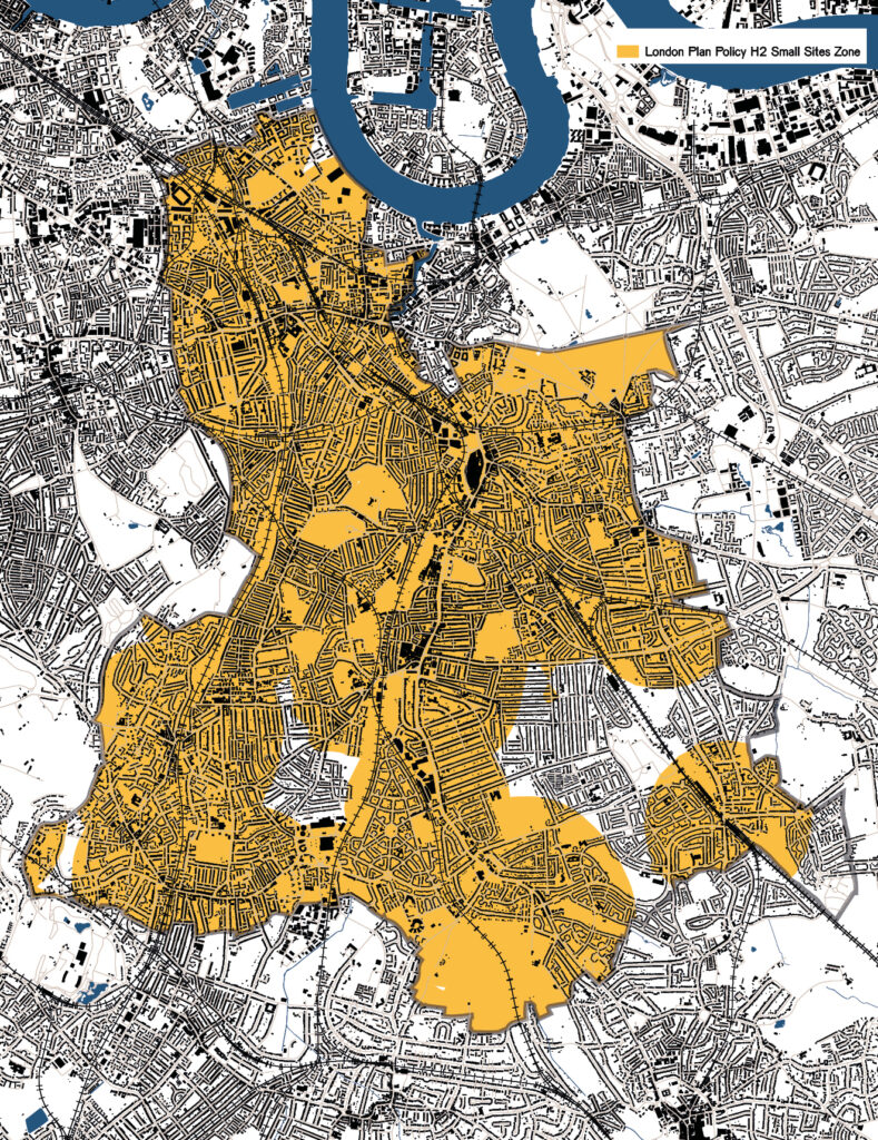
We have used detailed mapping of the borough to identify opportunities for intensification.
Further to understanding the borough’s areas by wards, character areas and focus areas, the borough has been analysed by urban development pattern.
Each area has been considered, enabling a stronger understanding of typical sites that occur across the borough. Using this mapping and other resources, potential locations for small sites development have been identified and catalogued.
The map opposite, for example, indicates areas which may be appropriate for intensification, based on their connectivity to high streets and public transport.
Further detail on mapping and identified areas for intensification can be found in Part 3: Appendices.