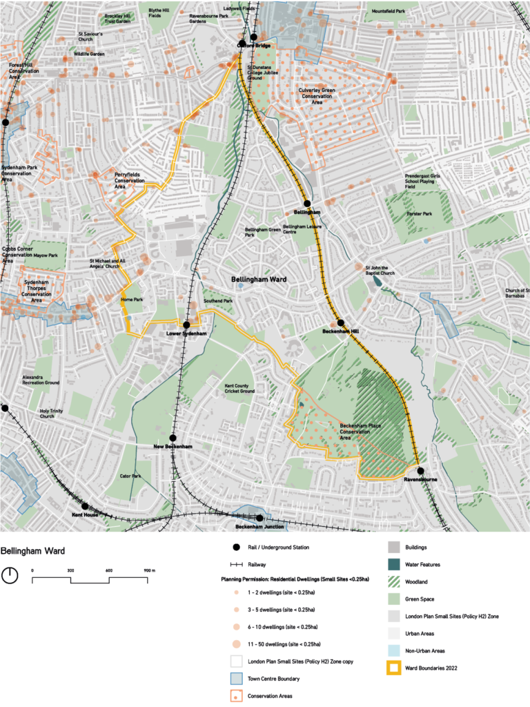
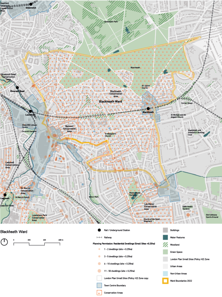
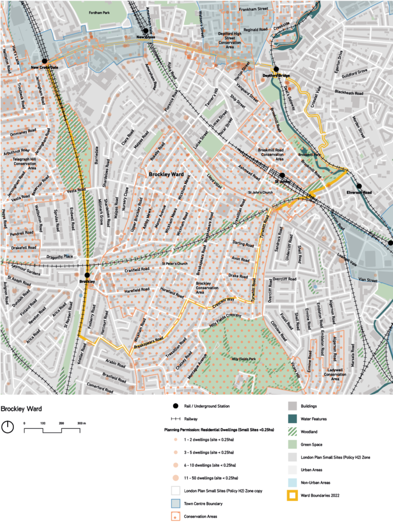
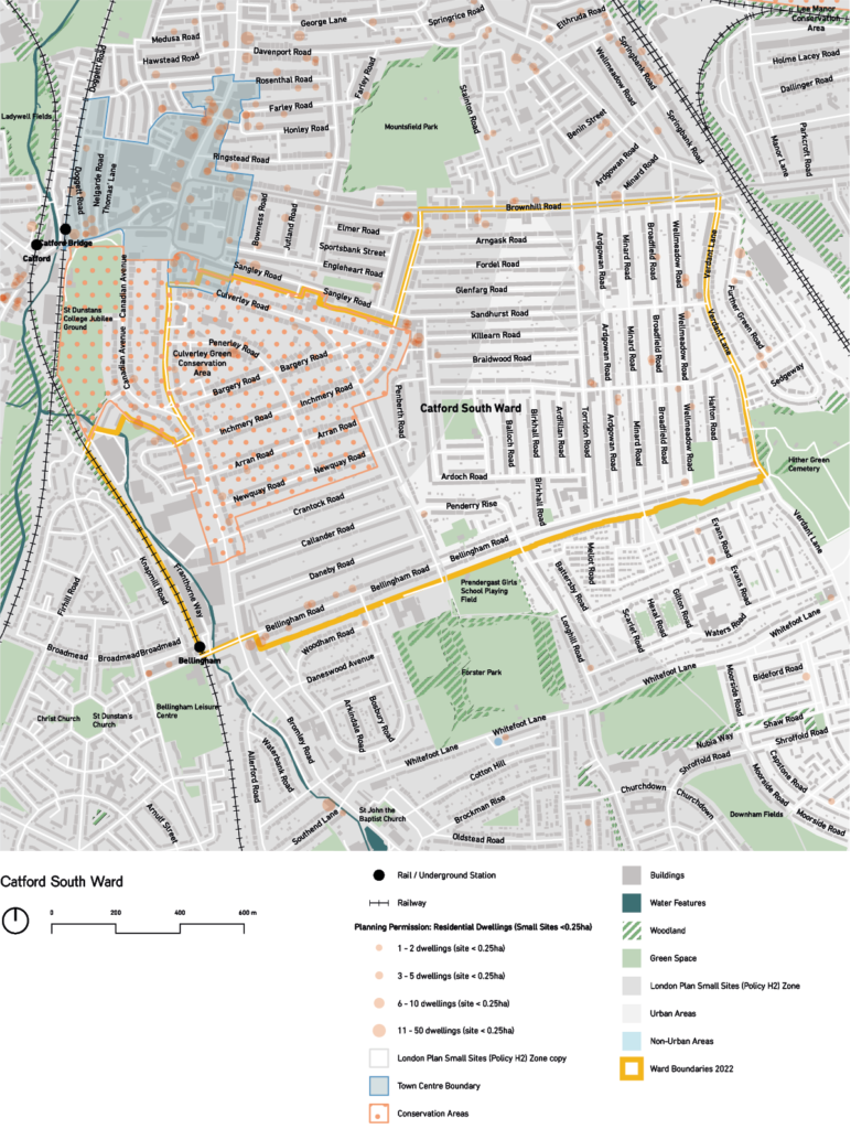
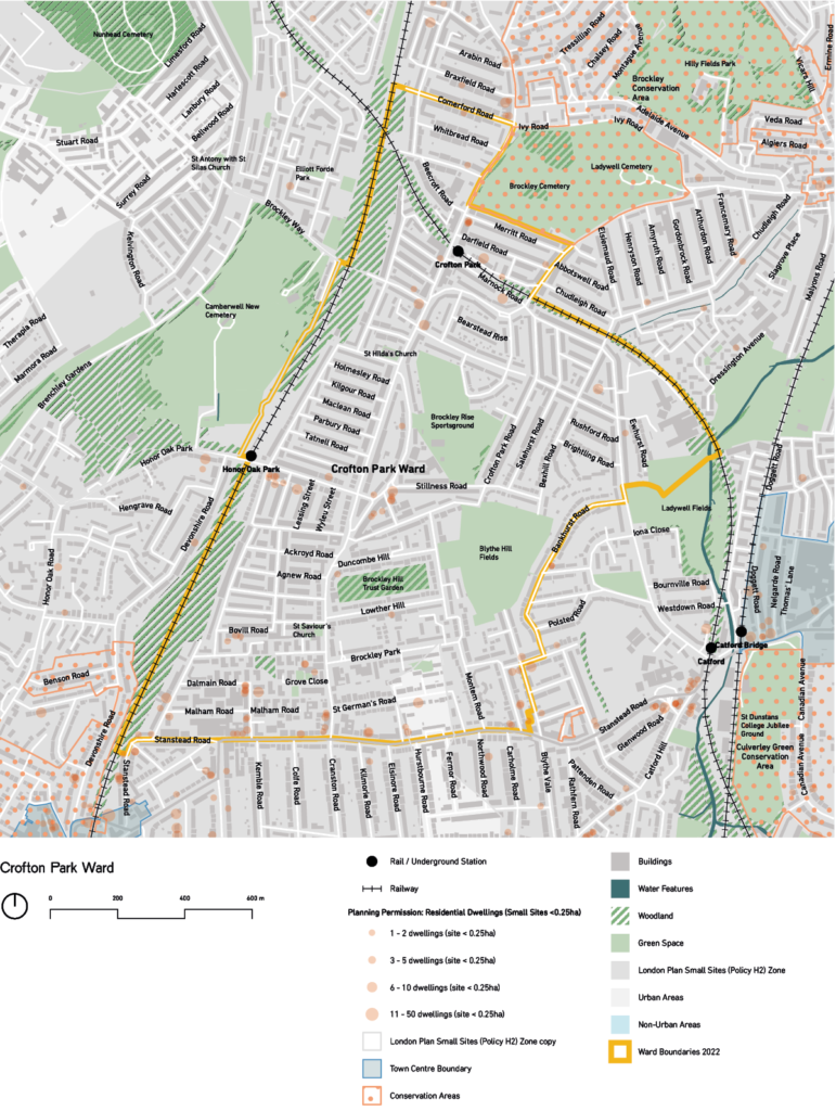
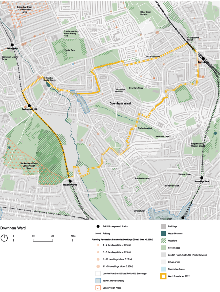
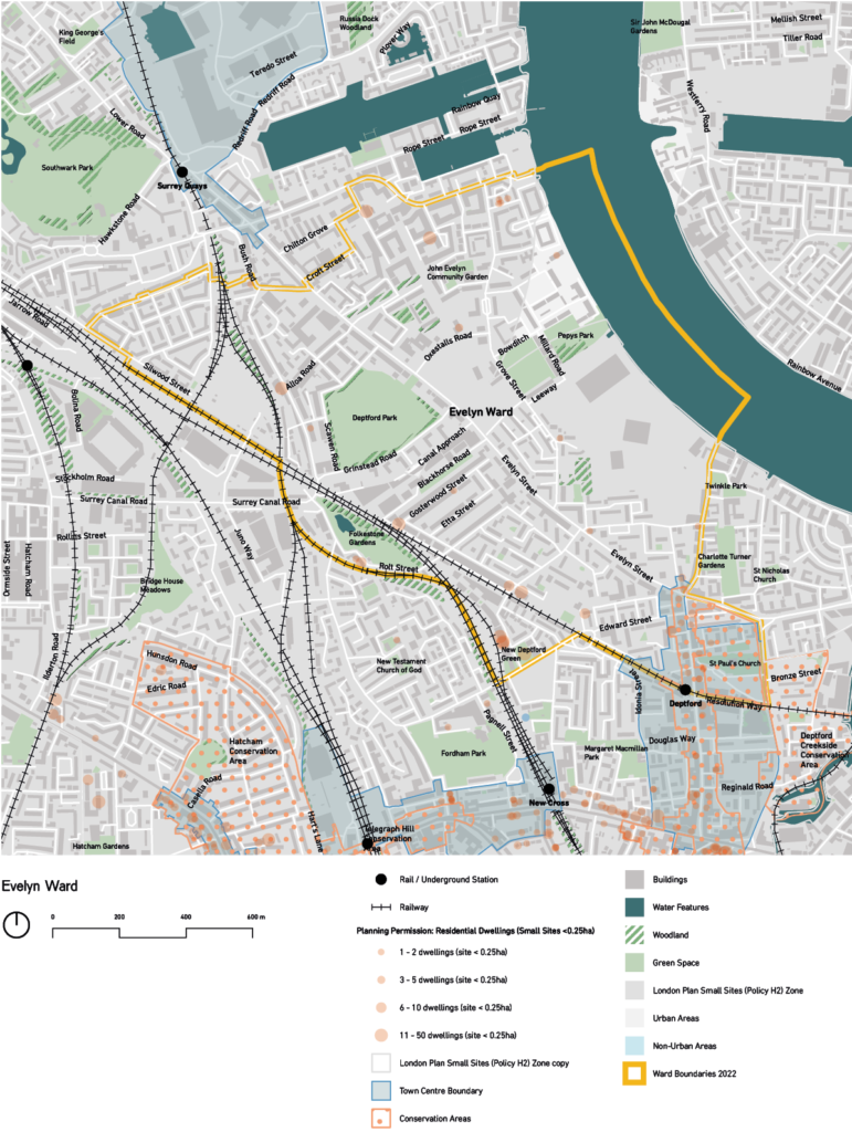
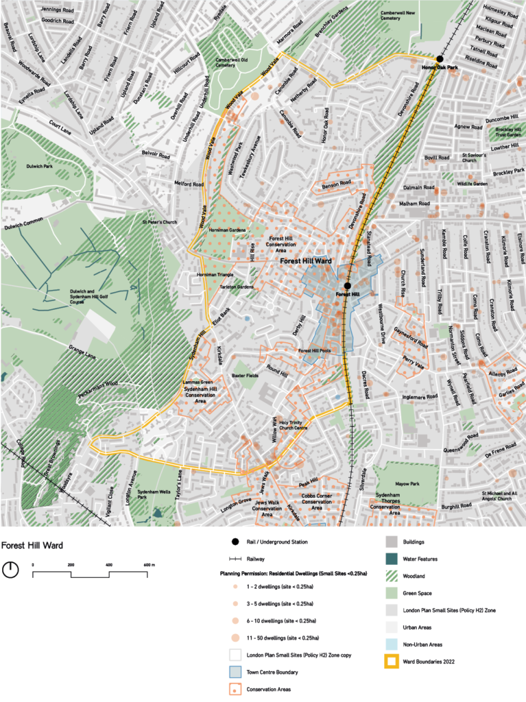
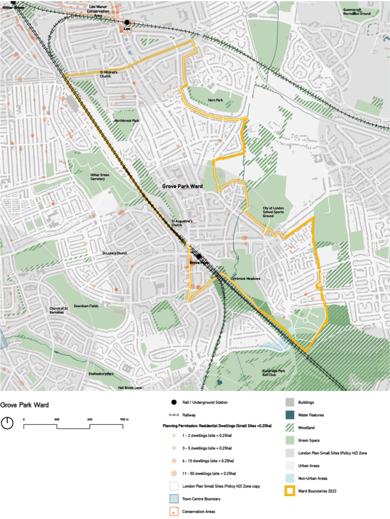
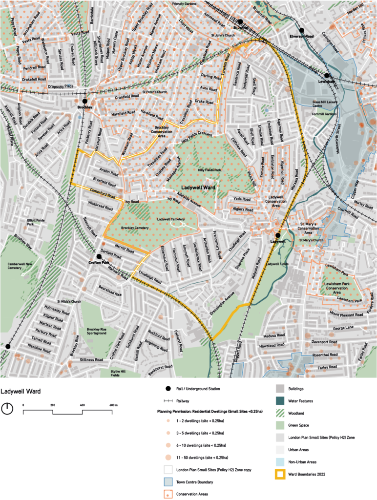
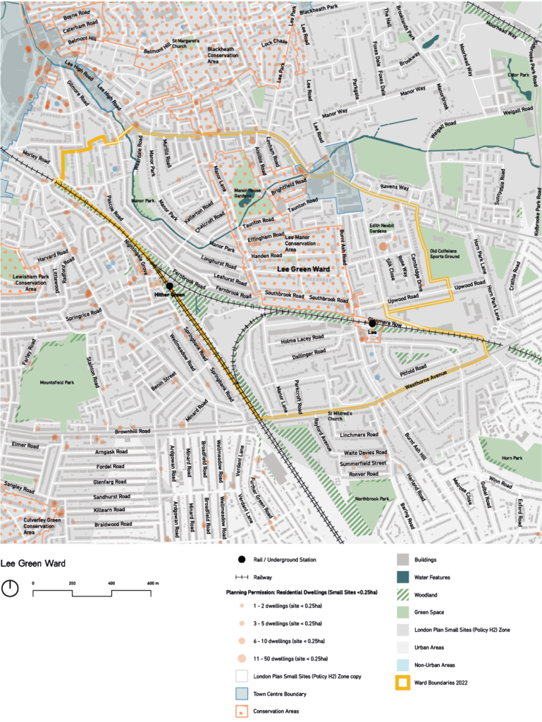
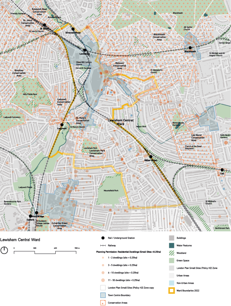
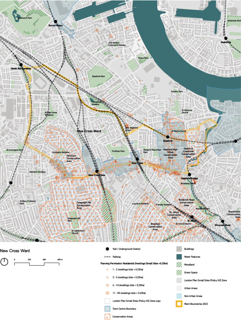
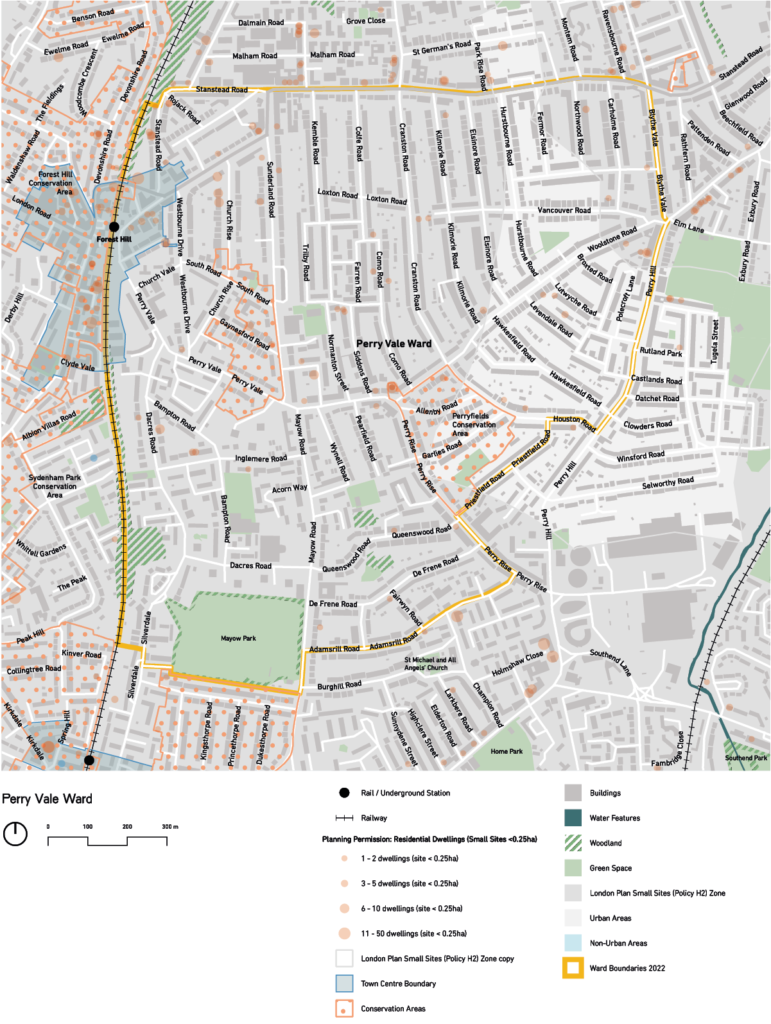
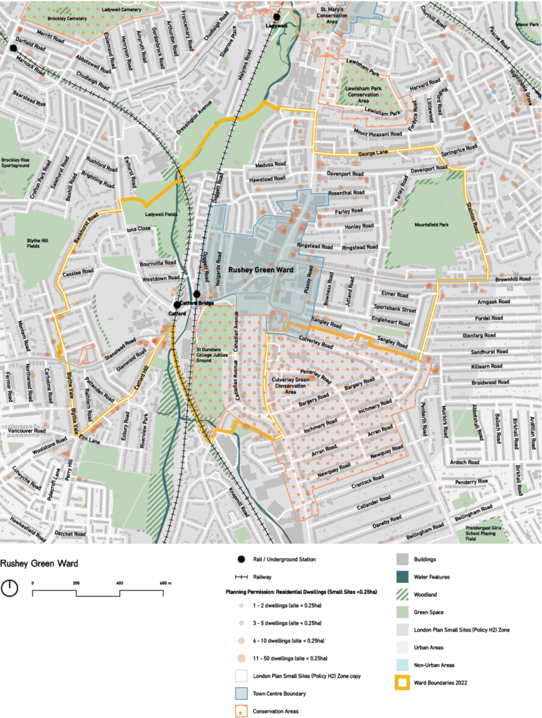
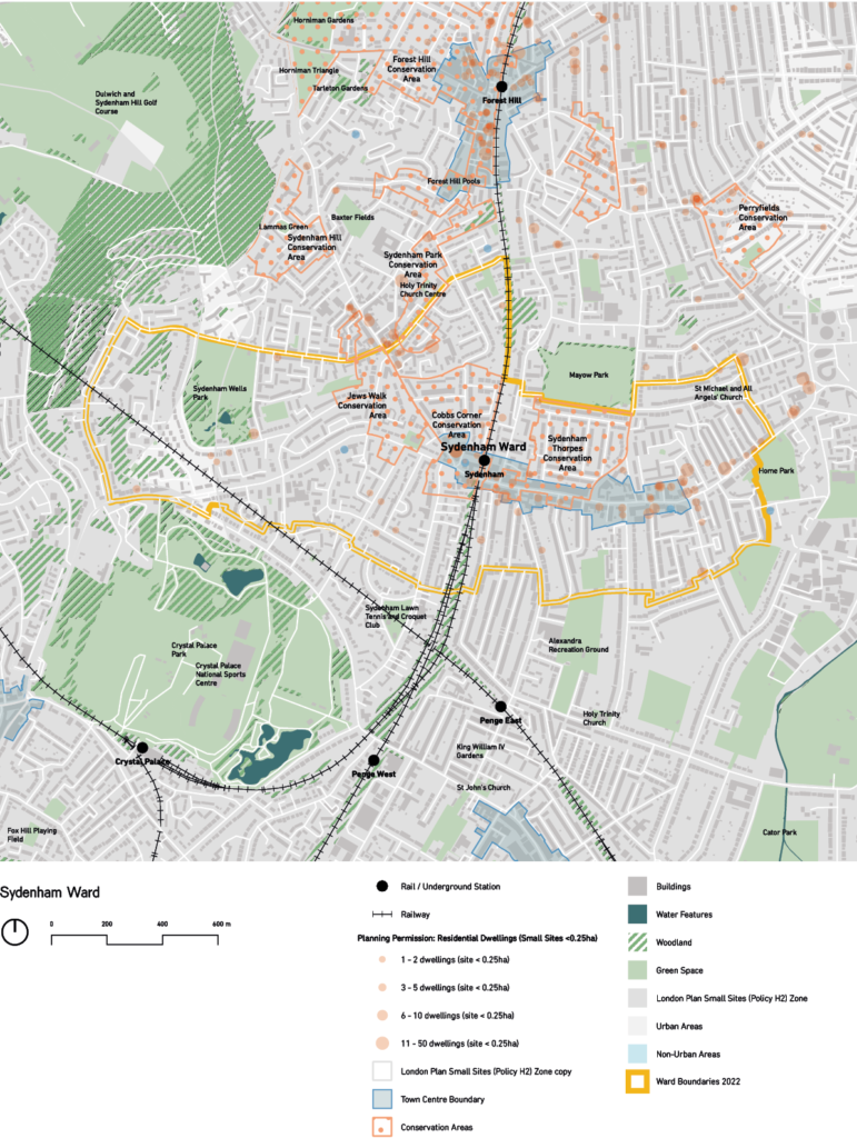
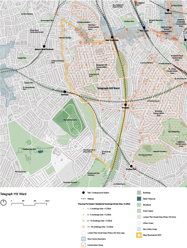
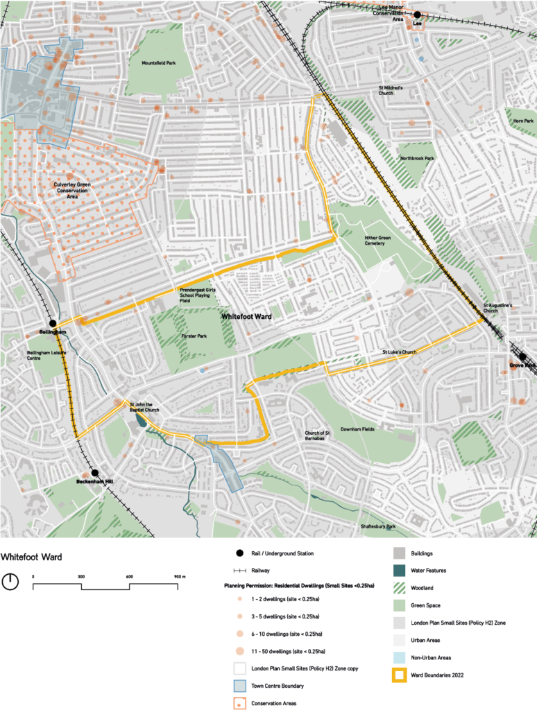
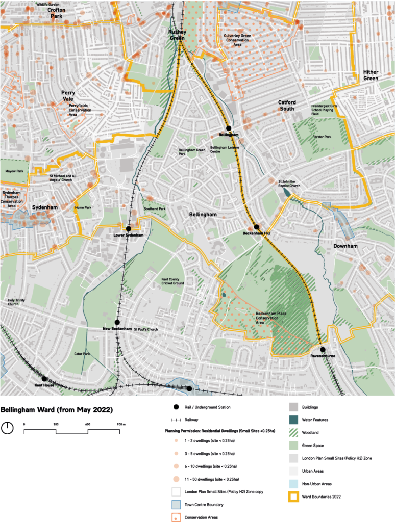
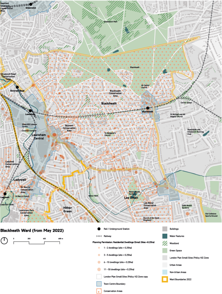
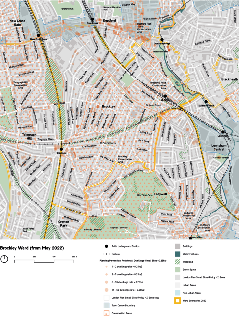
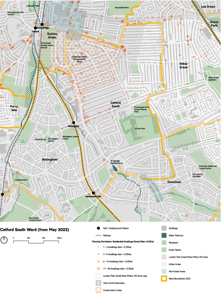
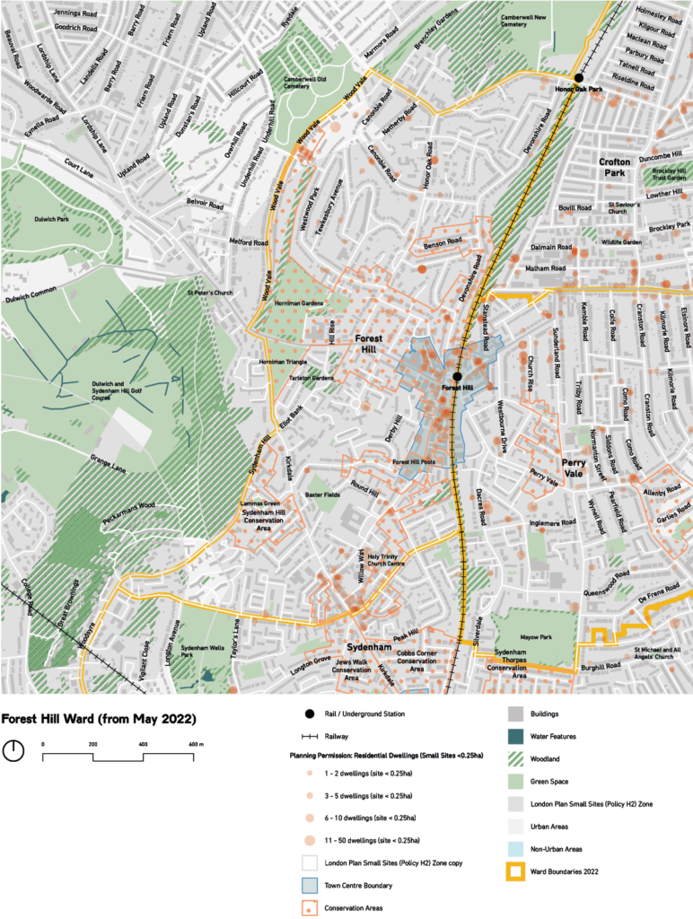
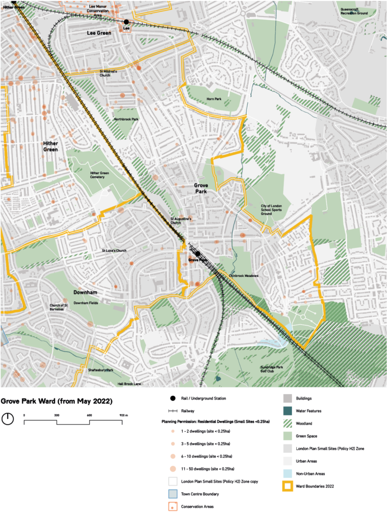
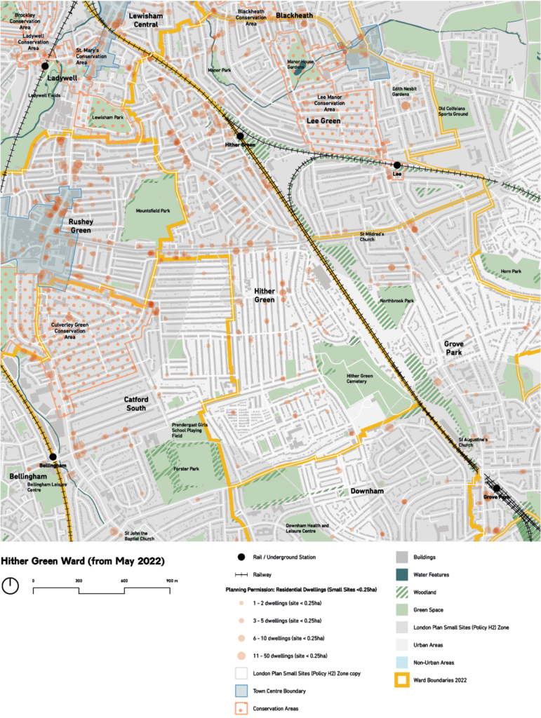
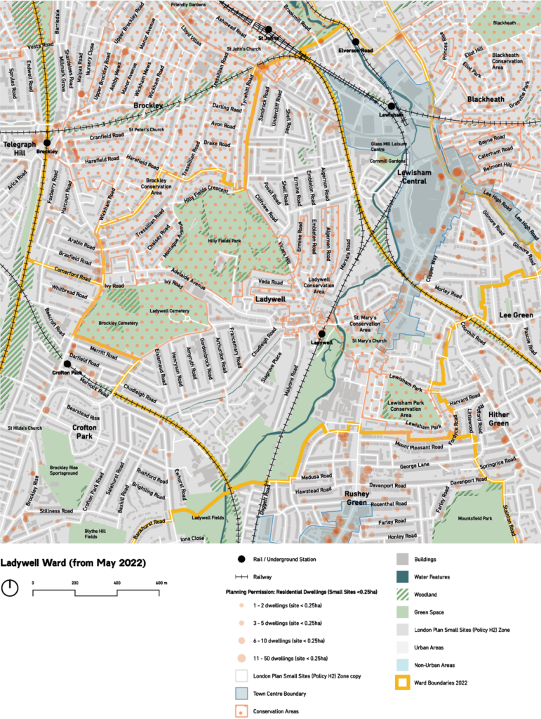
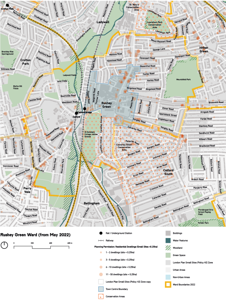
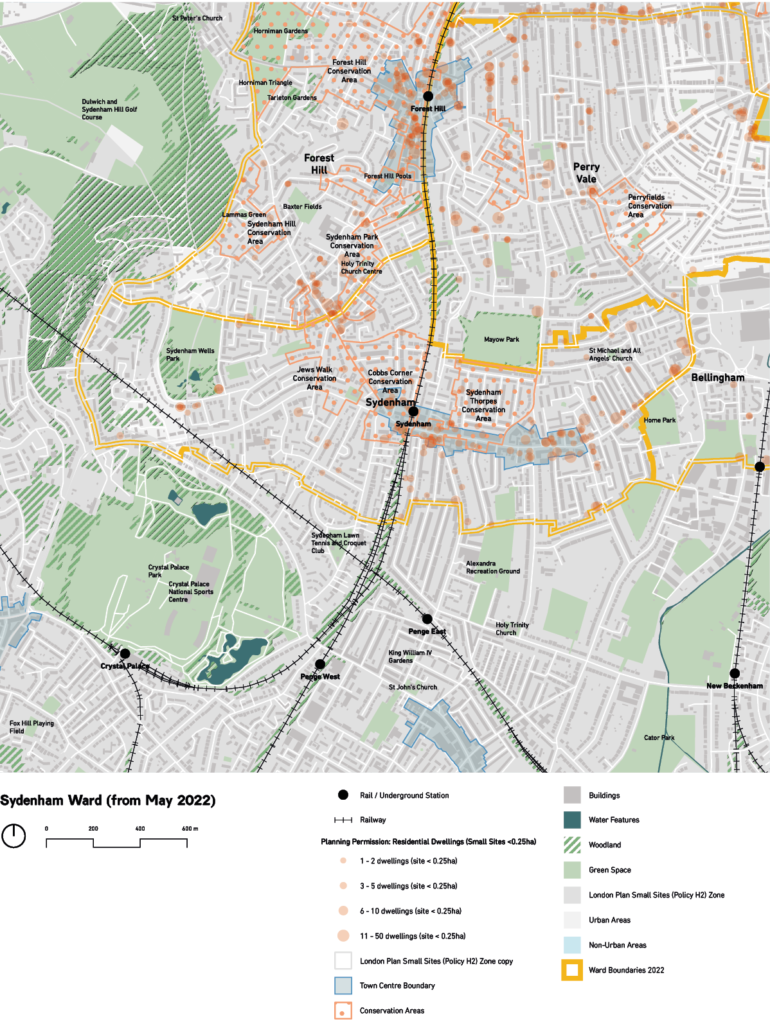
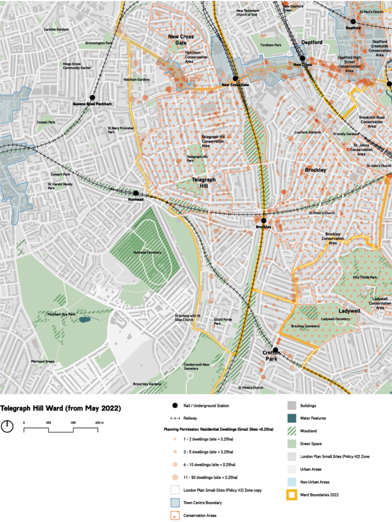
For each of the eighteen wards of Lewisham we have produced a map allowing us to understand the distinct administrative areas. Onto these maps we have overlaid additional data sets, including planning policy constraints, flood risk, public transport accessibility levels, and so on.
Some of these include details of small site planning approvals so that we can see where small site developments are successfully reaching completion, and where they are not. These maps also show the patterns of development, including applications which have been approved, but not built, so that we can build up a picture of the pattern of small site development across Lewisham.
Also identified on these maps are:
The 2021 London Plan H2 Policy area showing areas that are within 800 metres of a station, town centre boundary, or with a Public Transport Accessibility Level (PTAL) of 3 or more
Local policy areas, including conservation areas, town centre boundaries
Topographic information including contours, railways, roads, green space, woodlands, waterways and buildings
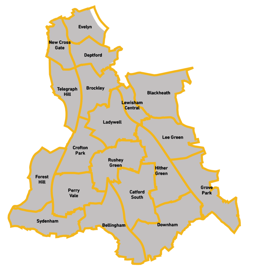
In May 2022 the ward boundaries and names will be changing, and the number of wards will change from eighteen to nineteen. The map to the right shows an overview of the updated boundaries and names.
On the following pages we have provided detailed maps for each of the wards as they were at the time of writing, and how they will be after the changes in 2022.
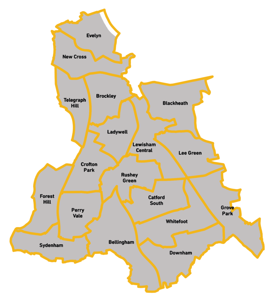
Figure 2: Map of Lewisham’s Wards up to 2022
Figure 3: Map of Lewisham’s Wards from 2022
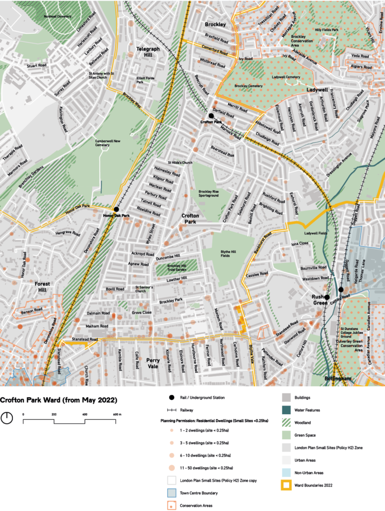
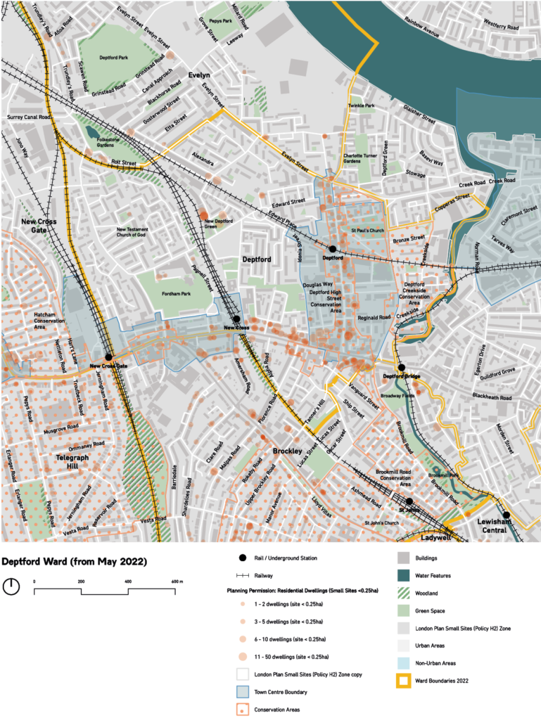
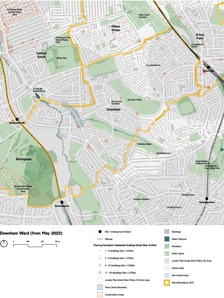
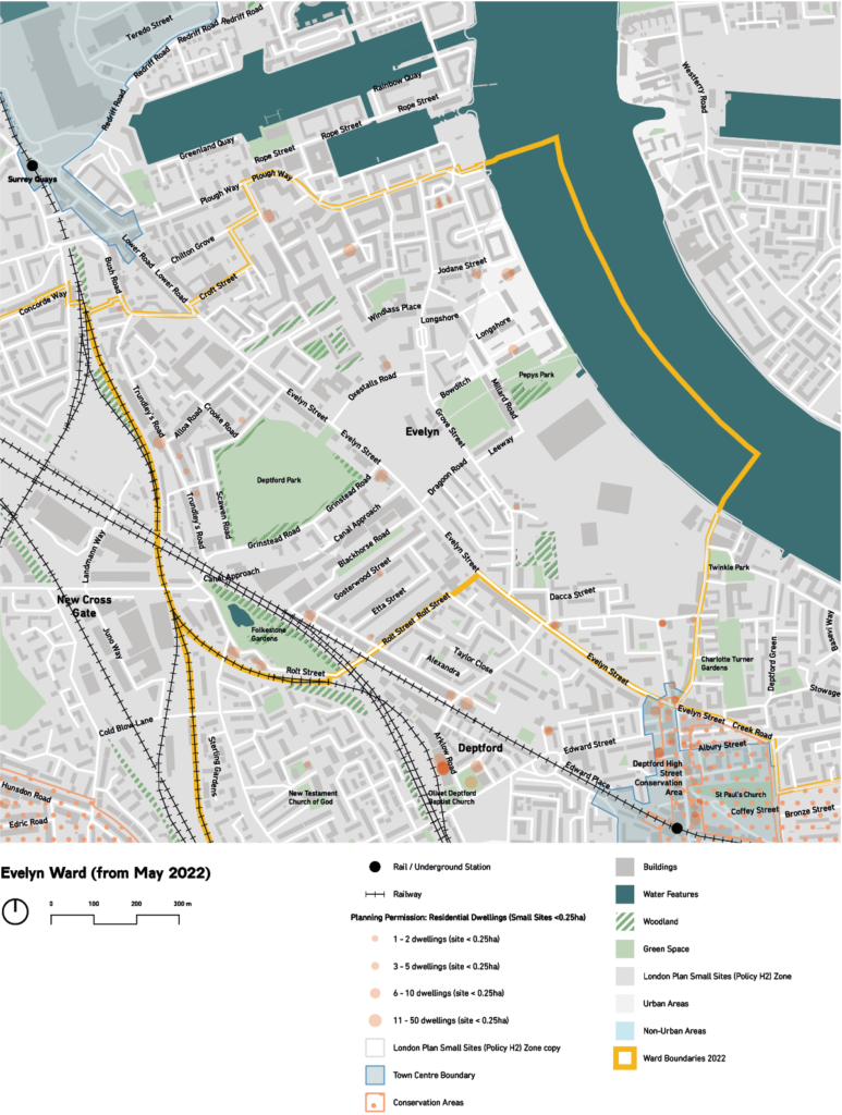
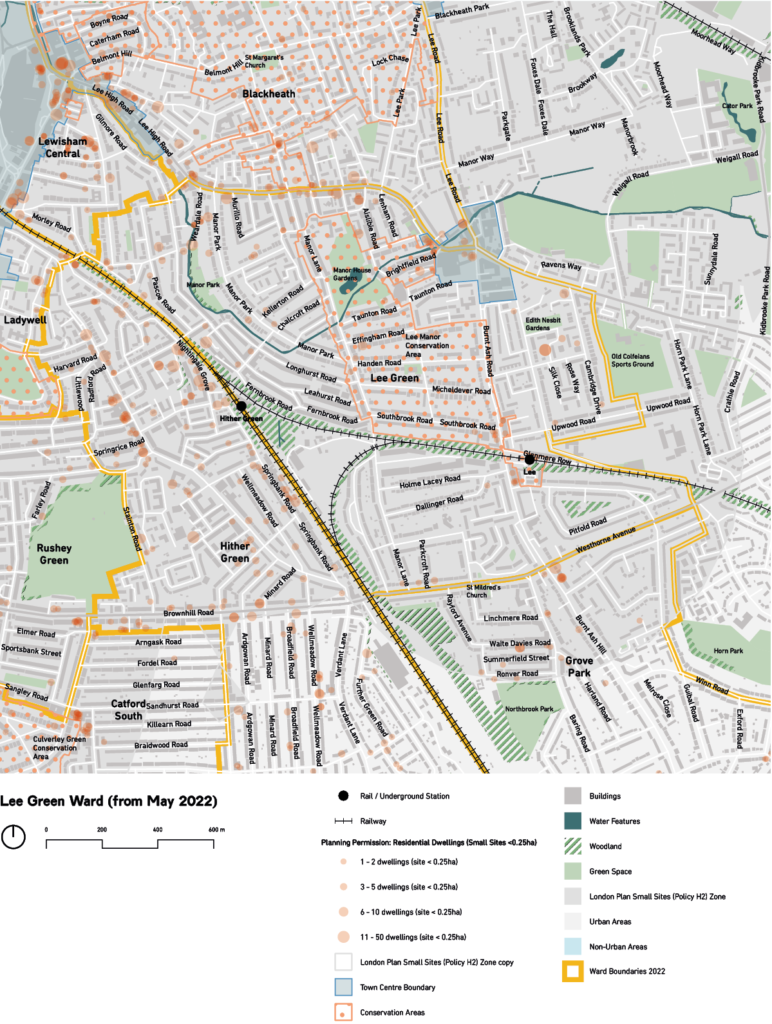
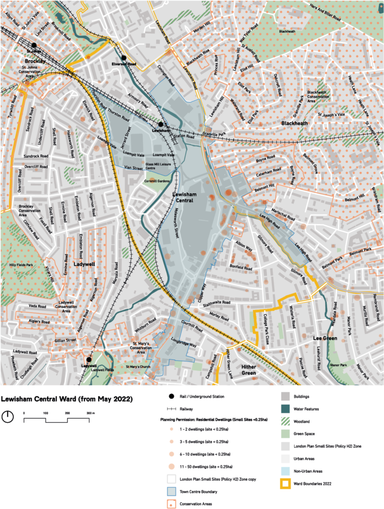
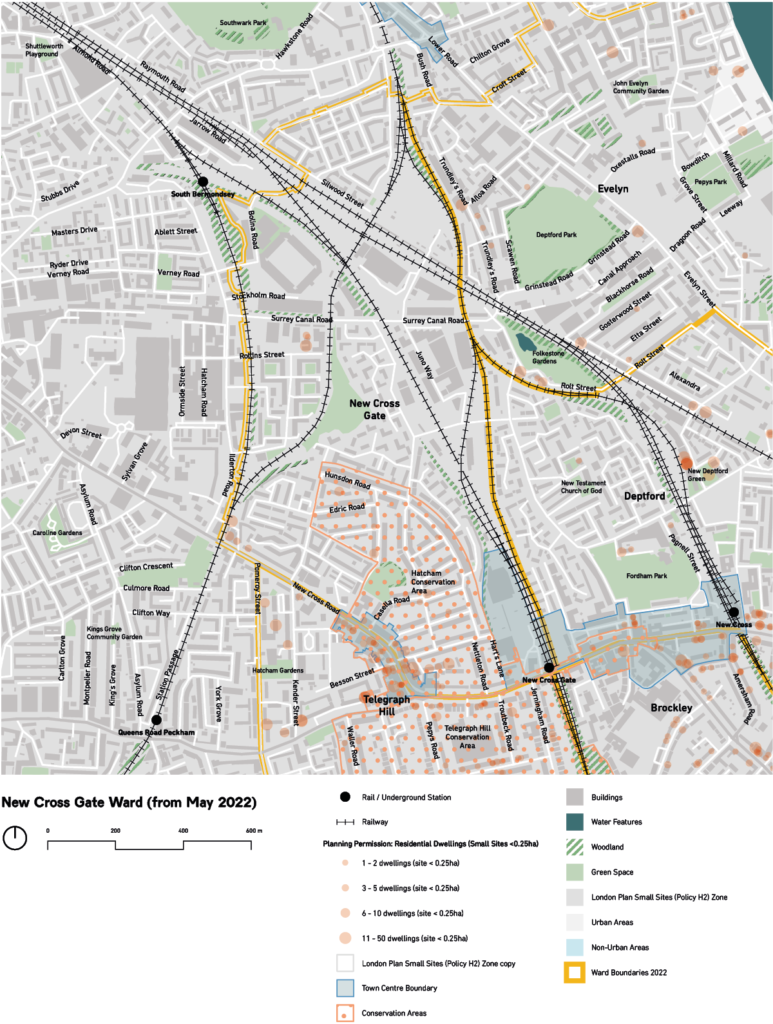
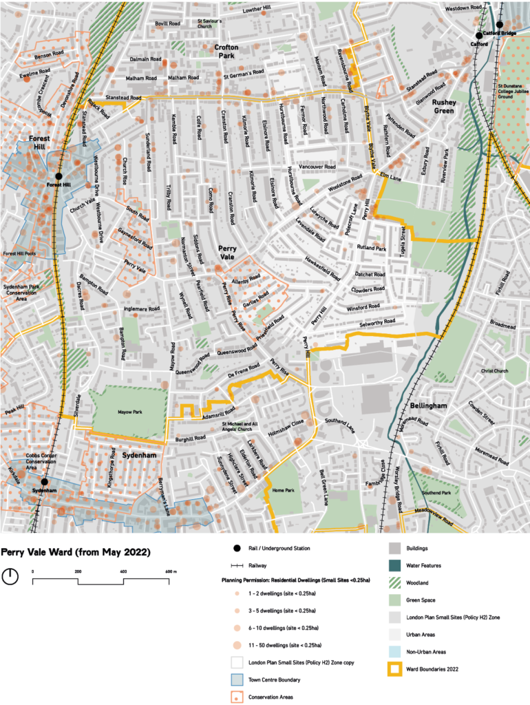
Figure 4: Map of Bellingham Ward (before May 2022)Figure 5: Map of Blackheath Ward (before May 2022)Figure 6: Map of Brockley Ward (before May 2022)Figure 7: Map of Catford South Ward (before May 2022)Figure 8: Map of Crofton Park Ward (before May 2022)Figure 9: Map of Downham Ward (before May 2022)Figure 10: Map of Evelyn Ward (before May 2022)Figure 11: Map of Forest Hill Ward (before May 2022)Figure 12: Map of Grove Park Ward (before May 2022)Figure 13: Map of Ladywell Ward (before May 2022)Figure 14: Map of Lee Green Ward (before May 2022)Figure 15: Map of Lewisham Central Ward (before May 2022)Figure 16: Map of New Cross Ward (before May 2022)Figure 17: Map of Perry Vale Ward (before May 2022)Figure 18: Map of Rushey Green Ward (before May 2022)Figure 19: Map of Sydenham Ward (before May 2022)Figure 20: Map of Telegraph Hill Ward (before May 2022)Figure 21: Map of Whitefoot Ward (before May 2022)Figure 22: Map of Bellingham Ward (from May 2022)Figure 23: Map of Blackheath Ward (from May 2022)Figure 24: Map of Brockley Ward (from May 2022)Figure 25: Map of Catford South Ward (from May 2022)Figure 26: Map of Crofton Park Ward (from May 2022)Figure 27: Map of Deptford Ward (from May 2022)Figure 28: Map of Downham Ward (from May 2022)Figure 29: Map of Evelyn Ward (from May 2022)Figure 30: Map of Forest Hill Ward (from May 2022)Figure 31: Map of Grove Park Ward (from May 2022)Figure 32: Map of Hither Green Ward (from May 2022)Figure 33: Map of Ladywell Central Ward (from May 2022)Figure 34: Map of Lee Green Ward (from May 2022)Figure 35: Map of Lewisham Central Ward (from May 2022)Figure 36: Map of New Cross Gate Ward (from May 2022)Figure 37: Map of Perry Vale Ward (from May 2022)Figure 38: Map of Rushey Green Ward (from May 2022)Figure 39: Map of Sydenham Ward (from May 2022)Figure 40: Map of Telegraph Hill Ward (from May 2022)