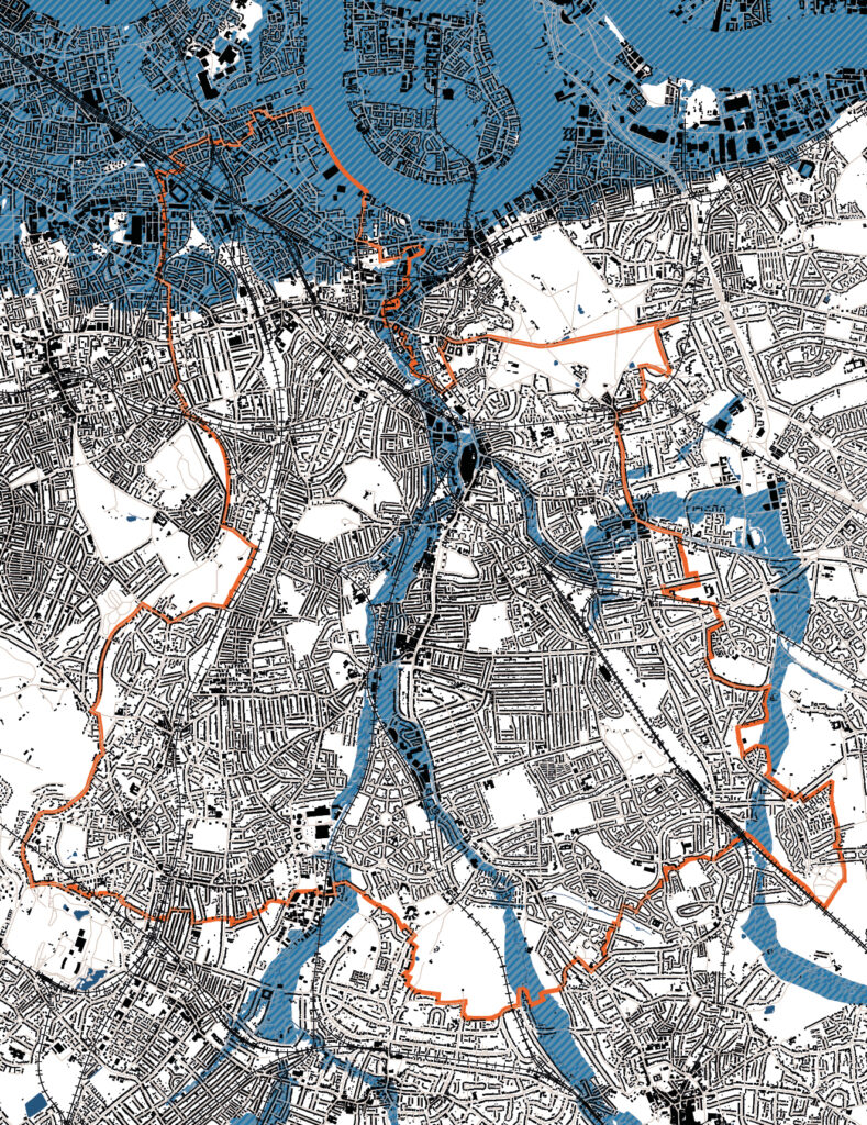
6. Planning Policy Areas
6.1. What are planning policy areas?
Planning policy areas are defined zones where additional planning controls exist. These are typically to protect particular qualities or features in an area such as natural habitats, areas of beauty or historical importance, and areas that provide important amenity.
6.2. Article 4 Direction / Permitted Development
Article 4 Directions are areas where the rights set out in the General Permitted Development Order have been withdrawn. This means that in these areas some of the types of development that would typically be classified as “permitted”, and therefore not requiring planning permission, will need to apply for permission.
There are several of these areas in Lewisham, including in some Conservation Areas where they exist to help preserve high quality architectural features and ensure that changes are undertaken sympathetically. There is also an Article 4 Direction in place in the south of the borough across much of Bellingham, Downham and Grove Park. This is as a result of poor quality houses of multiple occupancy (HMOs) being brought forward through permitted development.
This does not have a significant impact on small sites applications as generally there are advantages to following a planning application route to development even where permitted development rights exist.
You can find out where these areas are by referring to the planning section of Lewisham Council’s website.
6.3. Metropolitan Open Land (MOL)
Within the London Plan, land designated as MOL is afforded the same level of protection as the Metropolitan Green Belt. MOL designation is intended to protect areas of landscape, recreation, nature conservation and scientific interest which are strategically important.
Development proposals on land close or adjacent to MOL will be considered in relation to their detrimental impact on visual amenity, character or use of the MOL. MOL designations can be found within the London Plan or on Lewisham’s website.
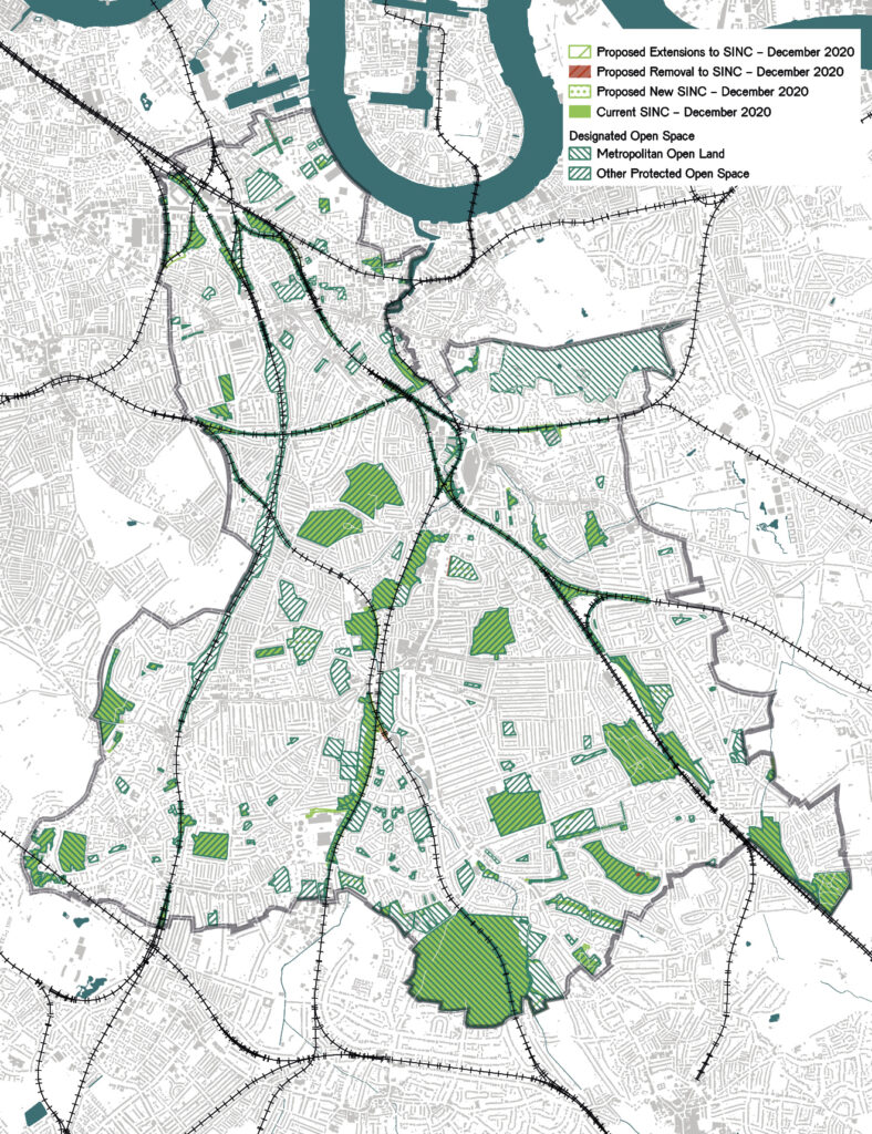
6.4. Sites of Importance for Nature Conservation (SINC)
There are currently 63 Sites of Importance for Nature Conservation (SINC) within the Borough of Lewisham. National and regional planning policy seeks to protect SINC land.
Development proposals on land close or adjacent to SINC will be considered in relation to their detrimental impact on visual amenity, character or use of the SINC. The impact that they have on the biodiversity and ecological values of the sites will also be considered to assess whether they would harm the sites and if so what mitigating or compensating measures are being taken.
Current SINC designations can be found within Lewisham’s website.
6.5. Site allocations
Lewisham’s Local Plan includes site allocation policies. Site allocations are a mechanism to facilitate development which meets the Council’s strategic objectives, and ensures targets for certain development types and provision are met.
These site allocations typically apply to sites that are larger than 0.25ha, and therefore are not small sites, but for more information on site allocations within Lewisham refer to the planning section of Lewisham’s website.
6.6. Public Transport Accessibility Level (PTAL)
PTAL is a measure of connectivity by public transport. For any selected location, PTAL suggests how well the place is accessible by the public transport network. It does not cover trips by car. PTAL values range from 0 to 6, where the highest value represents the best connectivity to public transport and therefore access to local amenities such as town centres and shops.
The London Plan sets out target housing density and parking requirements for the different PTAL ratings. A higher PTAL rating generally requires higher housing densities and lower car parking provision. An interactive map showing PTAL ratings can be found online on the TFL website.
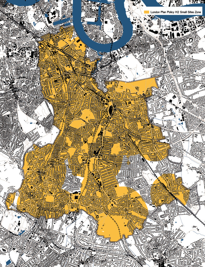
6.7. Priority areas
The London Plan sets out that “Incremental intensification of existing residential areas within PTALs 3-6 or within 800m distance of a station or town centre boundary is expected to play an important role in contributing towards the housing targets for small sites”.
The map on the opposite page sets out which areas of the borough fall within the zones set out above and are therefore priority areas for small sites development. As sites in this area are generally well connected, car-free developments should be considered. In addition to this, with the increase of home working and the improvement of cycle infrastructure, small, car-free developments should be considered where good cycle connections are available or proposed.
This is not to say that the parts of the borough which fall outside these priority areas are not suitable for small site intensification: the principles set out in this SPD apply to the whole of Lewisham.
6.8. Flood zones
The Environment Agency maintains a map of flood risk areas. The risk ranges from Zone 1 (low) to Zone 3 (high). Depending on the flood risk of a site, a flood risk assessment may be required as part of a planning application. Sites in flood Zone 1 and under one hectare generally don’t require a flood risk assessment. More information and an interactive flood zone map can be found on the government website ‘flood map for planning’.
Where required, a flood risk assessment will set out the risks and measures which you might need to put in place to mitigate the risk of flooding, such as moving sleeping accommodation to upper floors.
6.9. Neighbourhood forums and areas
Local people can influence the vision and planning policies for how they want their local area to evolve by producing a Neighbourhood Plan. Parts of Lewisham have already prepared Neighbourhood Plans, which cover specific characteristics of their respective areas and act as additional policy or guidance to the borough-wide policy documents.
The location of Neighbourhood Plans, and their corresponding policies, can be found on Lewisham’s website and should be consulted prior to preparing a planning application within an area they relate to.
6.10. Archaeological Priority Areas (APA)
APAs exist in areas where there is important known archaeological interest. They require developments to take extra care to ensure that they are not damaging potential heritage assets but in the most part do not restrict development.
Developers may be required to investigate the potential for significant archaeological deposits where the ground will be disturbed, and archaeological watching briefs, excavations and reports may be required by planning condition.
More information about APAs and where they exist can be found on the Historic England and Lewisham Council websites.
6.11. Conservation Areas
Conservation Areas are key planning policy areas that small sites developments need to consider, as the way we build in Conservation Areas can be different to other areas.
At the time of writing, there are 29 Conservation Areas in the Borough of Lewisham. More information on Conservation Areas can be found in section 7.
6.12. Summary
Information relating to the above constraints should be identified early in a project, typically as part of a desktop review. As we recommend in section 9, for small developments this would be best undertaken by a registered architect or planning consultant.